Help protect lake sturgeon when fishing this spring

DNR reminds anglers of lake sturgeon fishing regulations and rehabilitation efforts

As spring arrives, anglers fishing in our rivers may unexpectedly find themselves with a lake sturgeon on the line. The Michigan Department of Natural Resources reminds anglers that special regulations exist for lake sturgeon, and fishing for lake sturgeon is prohibited except in a few locations in the state.

Can anglers fish for lake sturgeon?

In the Lower Peninsula, lake sturgeon may be encountered in places such as Manistee Lake, the Manistee River, Muskegon Lake, the Muskegon River, the Grand River, the Kalamazoo River, and Saginaw Bay and its tributaries, but it is unlawful to fish for lake sturgeon in these waters; any lake sturgeon incidentally caught while targeting other species must immediately be released. Additionally:

  • Never hold a sturgeon in a vertical position by its head, gill covers or tail.
  • Never touch the fish’s eyes or gills.
  • Handle the fish as little as possible.

Waters with sturgeon possession seasons include Lake St. Clair and the St. Clair River, Otsego Lake, the Menominee River and Black Lake. Waters with sturgeon fishing seasons (catch-and-release only) include the Detroit River, the St Marys River, Portage-Torch Lakes and the Ontonagon River.

In all other waters in the state of Michigan, it is unlawful to fish for lake sturgeon. (See Page 15 of the 2025 Michigan Fishing Regulations for detailed information related to lake sturgeon.)

Anglers can report incidental (unintentional) capture of lake sturgeon and report illegal harvesting or targeting of lake sturgeon at Michigan.gov/EyesInTheField or by calling the DNR’s Report All Poaching hotline: 800-292-7800.

What is special about lake sturgeon?

Close up lake sturgeon
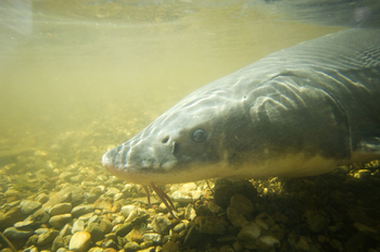
Lake sturgeon (Acipenser fulvescens), the only sturgeon species found in the Great Lakes, are unique in appearance and characteristics. They have five rows of bony plates, called scutes, on their backs and sides, as well as whisker-like barbels near their mouths.

Often referred to as “living fossils” or “dinosaur fish,” lake sturgeon first appeared in the fossil record in the Mesozoic Era, 100 million to 150 million years ago. These fish are long-lived, with some documented at more than 100 years old.

Lake sturgeon are freshwater fish native to Michigan and found in North America throughout the Great Lakes, Mississippi and Hudson River basins. In addition to having high ecological significance, the species is an important cultural resource in our region. Due to overfishing and habitat loss and degradation, however, lake sturgeon abundance remains low throughout most of its historical range.

read more – https://content.govdelivery.com/accounts/MIDNR/bulletins/3de8e62

A collaborative study tracks collared moose in western UP

The moose are loose – collaborative study tracks collared moose in western UP

Researchers fitted 20 moose with GPS collars to study species’ survival challenges

By RACHEL LINCOLN, communications representative
and JOHN PEPIN, deputy public information officer
Michigan Department of Natural Resources

The moose population in the western Upper Peninsula has been a subject of great interest and conversation for decades. People want to know how many moose there are, where they are located and whether there will ever be an opportunity to hunt them.

This curiosity stems from Michigan’s efforts to restore moose to the region and the iconic status of the animal – a species many people have never seen.Moose study Michigan


Once on the verge of disappearing from the state, moose were successfully reintroduced in the western Upper Peninsula from Canada in the mid-1980s.

Forty years later, their population has grown but failed to reach the goal initially hoped for of 1,000 animals by the year 2000. The population in this core moose area in the western U.P. grew steadily between 1997 and 2007 before slowing significantly.

The 2023 biennial aerial survey estimated 426 moose.

To better understand why the population has faltered, researchers recently embarked on an exciting study to investigate the movements and mortality of moose in the western U.P.

In late February, wildlife researchers from the Michigan Department of Natural Resources, Keweenaw Bay Indian Community and Northern Michigan University fitted 20 moose with GPS collars to track their location.

With the help of a skilled helicopter crew and fixed-wing spotter planes, the moose were located among snow-covered wetlands and forests.


read more: https://content.govdelivery.com/accounts/MIDNR/bulletins/3d7e6ff

Lake and stream surveys are critical to managing Michigan fisheries

Aug. 15, 2024
Contact: Jim Francis, 517-242-3593 or Marcee Wardell

DNR inland lake and stream surveys are critical to managing Michigan fisheries

Crews completed more than 280 surveys in 2023

A Michigan DNR team surveying the River Raisin in southeast Michigan.
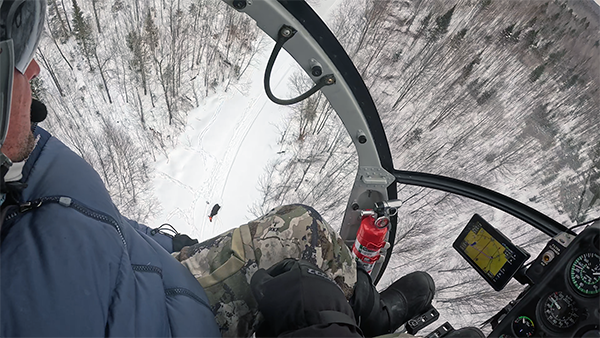
If you spent any time on the water last year, you may have seen Michigan Department of Natural Resources fisheries management units at work conducting fisheries surveys across the state. Crews completed 171 surveys of Michigan’s inland lakes and 110 surveys of Michigan’s streams in 2023.

These surveys are valuable, helping track inland fisheries populations, evaluate stocking efforts to increase angler opportunities and address concerns from anglers.

Collecting key data on Michigan’s world-class fisheries is critical for successful management of the state’s diverse fisheries resources, but what exactly do crews look for? According to Jim Francis, DNR Fisheries Division Lake Erie basin coordinator, surveys fall into three categories:

  • Evaluating management actions.
  • Understanding status and trends.
  • Finding answers to new questions or concerns.

“The management units stepped up this year and were able to safely conduct inland fisheries surveys to evaluate if management actions, like fish stocking or habitat improvement projects, had the desired effect,” Francis said. “Surveys help us understand whether or not our management actions resulted in better recreational fishing in certain areas or improved a lake’s overall health.”

Francis explained that, at fixed status and trends sites, the DNR annually estimates fish population abundance — usually trout in coldwater streams and smallmouth bass in warmer waters — on a three-year rotation, while random site surveys are intended to give a species snapshot and show relative abundance. The DNR collects in-stream habitat data at all status and trends sites.

Fisheries managers use the third category, discretionary surveys, to answer questions or address current concerns, perhaps something raised by a local biologist, an angling group or a lake association. Such surveys, typically accounting for 50% of the department’s annual survey effort, might be conducted to assess habitat suitability for a threatened and endangered fish species.

Such surveys are critical to a detailed, accurate understanding of state fisheries and aquatic health, and the DNR’s ability to regularly complete the surveys is dependent on sufficient, sustainable, long-term funding.

DNR Fisheries Division Chief Randy Claramunt said that under the DNR’s current funding level, an inland lake in Michigan is likely to be surveyed only once every 90 years, which isn’t viable. Fisheries managers use the information from surveys to strategize their actions, detect early indicators of invasive species, recognize developing threats to fish and habitat health, and many other important activities. 

“Additionally, anglers rely on this information when planning fishing trips, and many DNR partners depend on these surveys to inform strategic efforts such as habitat protections,” Francis said. “Well-managed, high-quality aquatic habitats and waters are things all residents benefit from.”

If you’d like to learn about the DNR’s lake and stream surveys, especially in your part of the state, contact the fisheries management unit in your area. For more on how the department takes care of fisheries, visit the DNR’s fisheries management webpage.


Note to editors: An accompanying photo is available below for download. Caption information follows.

  • River Raisin: A DNR team uses electrofishing to survey the River Raisin in southeast Michigan. Survey data of inland fisheries informs how these fisheries are managed.

Great Lakes Acoustic Telemetry Observation System network

We all know fish swim and move. But the when, where and why often remains a mystery for anglers and fisheries managers alike. 

Managing fish populations requires a comprehensive understanding of fish behavior ­– driven by the biology of the fish and the environments they live in ­– as well as the anglers who value and enjoy Michigan’s world-class fisheries. Understanding angler behavior is relatively easy because people talk and can tell us what they like to catch and what motivates them to fish.  Fish behavior, on the other hand? Well, that is more of a challenge. 

The animals we are passionate about, both as anglers and resource managers, aren’t vocal and remain hidden in the depths of Michigan’s waters, where their movements are mostly unseen.  Fortunately, fisheries managers in Michigan have adopted an advanced technology to unravel the mysteries of when, where, why and even how far fish travel. That technology is acoustic telemetry, and the information gained from this high-tech tracking method is helping fisheries managers address a variety of challenges, including conserving native stocks, controlling invasive species and understanding habitat use. 

Great Lakes Acoustic Telemetry Observation System network

acoustic receiver anchored underwaterDeciphering fish movement patterns in the Great Lakes with acoustic telemetry became much easier in 2010, with the creation of the Great Lakes Acoustic Telemetry Observations System. The GLATOS network uses cutting-edge technology to repeatedly observe the location of individual fish across short time intervals.

The ability to record the location of an individual fish over time is a substantial advancement from previous methods that solely relied upon knowing the release location of a uniquely marked fish and a subsequent recapture location, often provided by an angler. While the data from these methods are informative, a major shortcoming is that they provide no information on how the fish behaves between the time it was released and recaptured.

So how does acoustic telemetry work? The GLATOS network functions as a surveillance grid, consisting of receivers, or “listening stations,” strategically placed throughout the Great Lakes and capable of recording detections of fish that have been implanted with individually coded acoustic transmitters – or “pingers” – that the receivers are constantly listening for. This network of receivers and pinging fish provides vast spatial coverage of some of the largest lakes in the world and is supported by intensive collaborations among several state, federal and tribal fisheries resources agencies, universities and nongovernmental organizations.

There are currently more than 3,000 receivers in the Great Lakes Basin in the process of detecting pinging fish. An astonishing 24,000 fish have been implanted with acoustic transmitters since the GLATOS network was created, providing fisheries managers with year-round, 24/7, fine-scale fish behavior data that was never available before. 

Read on for a snapshot of what biologists have learned about some of Michigan’s most popular fish species, starting in Lake Michigan and taking a clockwise trip around The Mitten.   

Lake Michigan whitefish

DNR biologist implanting acoustic transmitter into fishLake whitefish yields in Lake Michigan and Lake Huron have declined by more than 50% since the early 2000s. Although the reasons for these declines remain somewhat unclear, the lasting effects of invasive species on Great Lakes habitat and food webs are certainly at play. For example, the smothering of rocky spawning reefs by invasive zebra and quagga mussels may be reducing lake whitefish egg deposition and survival.

As part of an effort to ultimately restore this lost reef habitat, researchers from the Michigan Department of Natural Resources and other agencies are using acoustic telemetry to characterize fine-scale movement patterns of lake whitefish on several reefs in northern Lake Michigan during the fall spawning season. Many acoustic receivers are placed closely together over the spawning reefs to precisely determine the position of acoustic-tagged fish and their spawning locations. Pairing these positional data with high-resolution maps of the water depths and lake bottom around the reefs allows researchers to examine the habitat characteristics that concentrate lake whitefish during the spawning season.

These data indicate that shallow reef complexes have “hot spots” for spawning activity that often correspond with shallow, low-sloping, rocky ridges. The collection of eggs on these hot spots has affirmed that acoustic telemetry data can be used to correctly identify spawning locations where egg deposition is occurring. Researchers are now using these high-resolution data to prioritize experimental invasive mussel removal efforts on spawning reefs to locally increase egg deposition and survival.

Saginaw Bay walleye

An acoustic transmitter being implanted into a walleye
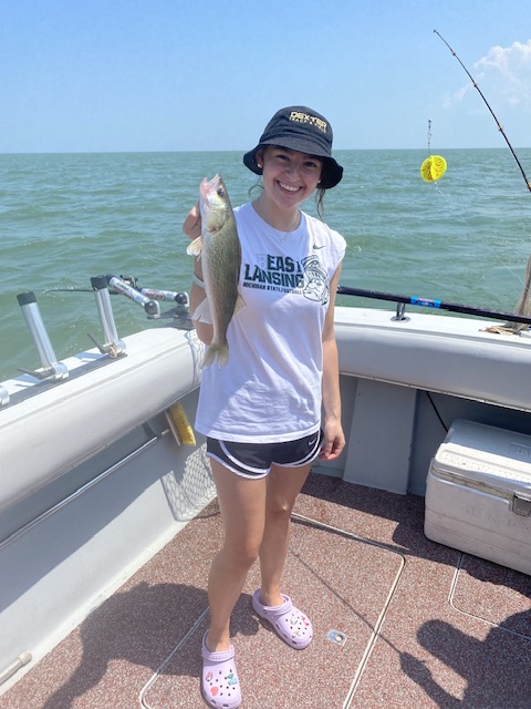
Decades-long jaw tagging experiments have shown that some walleye leave Saginaw Bay for the main basin of Lake Huron, but before the GLATOS network was available, little was known about the actual proportion, timing and range of their movement. Acoustic telemetry led to the discovery that nearly 40% of Saginaw Bay’s walleye migrate into the main basin by June 1 each year, with no movement out of the bay later in the year. The fish that leave Saginaw Bay travel long distances and repeatedly go to the same destinations each year before returning in the fall to overwinter and spawn again the following spring.

Researchers aren’t sure why some walleye migrate and others remain residents of the bay, but whichever behavior they exhibit is consistent each year. These details about fish movement are very important for stock assessment and for setting fishing regulations, because they help managers understand when and where fish will be susceptible to angler harvest. 

More recently, acoustic telemetry is being used to learn where walleye are spawning in Saginaw Bay and how these spawning fish use the different rivers and reefs in the bay.  This work will help fisheries managers know which spawning locations are the most important to protect and perhaps pursue improvements to fish passage in rivers or restore reef habitat.

Muskie and smallmouth bass in the Lake St. Clair-Detroit River system

DNR fisheries research technician prepares to release an acoustically tagged muskellungeThe muskellunge and smallmouth bass fisheries in Lake St. Clair and its connecting waters are world-famous and renowned for their high catch rates. The Michigan DNR and its partners have been using the GLATOS network to better understand the behavior of these two species that are the target of substantial angler effort in southeast Michigan. 

Acoustic telemetry revealed widespread movements of muskie throughout Lake St. Clair, the Detroit River and Lake Erie, including the movement of one fish from its tagging location in the Detroit River all the way to Buffalo, New York, and back!  Movements like this demonstrate the potential connectivity of Great Lakes muskellunge populations, the movement potential of individual fish, and the importance of collaborative and well-coordinated interagency fisheries management for populations that cross state and provincial borders. 

Meanwhile, investigations of smallmouth bass in Lake St. Clair demonstrate that they tend to remain in relatively confined areas within the lake, like Anchor Bay in the northern part of the lake or the Mile roads on the western shoreline, despite frequent movements within those areas. This behavior suggests that the Lake St. Clair smallmouth bass population could be comprised of different subpopulations of fish, which may have their own demographics. The characteristics of these unique subpopulations must be accounted for when managing the lake as a whole.

Can anglers assist with acoustic telemetry research?

Yes! Anglers can and do provide a great deal of help with ongoing acoustic telemetry studies in the Great Lakes. Many of the fish that are currently pinging have external tags on their bodies that indicate an acoustic transmitter is implanted inside. When anglers catch one of these fish, they should call the phone number on the external tag or visit the Michigan DNR Eyes in the Field online reporting system to tell us, making sure to record the details on the external tag, including the tag number, prior to reporting. If the fish is harvested, the DNR can make arrangements to collect the acoustic transmitter, which can sometimes be reused in another fish. When a fish with an acoustic tag is captured by an angler and released, reporting the capture location helps biologists to confirm the fish is alive and verify its location.

If you’re interested in learning more about fish and the places they go, be sure to visit the GLATOS website for a variety of news articles and scientific publications highlighting the results of this important work throughout the Great Lakes Basin.

Check out previous Showcasing the DNR stories in our archive at Michigan.gov/DNRStories. To subscribe to upcoming Showcasing articles, sign up for free email delivery at Michigan.gov/DNREmail.


Note to editors: Contact: John Pepin, Showcasing the DNR series editor, 906-226-1352. Accompanying photos and a text-only version of this story are available below for download. Caption information follows. Credit Michigan Department of Natural Resources, unless otherwise noted.

Bass: A smallmouth bass with a freshly implanted acoustic transmitter and external anchor tag, extending from the fish’s stomach.

Implanting: Michigan Department of Natural Resources fisheries research biologist Jan-Michael Hessenauer surgically implants an acoustic transmitter into a smallmouth bass.

Muskellunge: Michigan Department of Natural Resources fisheries research technician Brad Utrup prepares to release an acoustically tagged muskellunge on Lake St. Clair.

Receiver: An acoustic receiver anchored underwater. More than 3,000 receivers in the Great Lakes Basin are currently in the process of detecting signals from fish implanted with individually coded acoustic transmitters. (Photo credit: T. Binder, Great Lakes Fishery Commission via GLATOS)

Transmitter: An acoustic transmitter being implanted into a walleye. After the transmitter is implanted, the body cavity is surgically sutured prior to releasing the fish into the water. 

Lake Erie “The Walleye Capital of the World”

Lake Erie anglers can expect the 2024 fishing

season to again offer world- renowned opportunities, according to the DNR.Lake Erie Charter fishing trip aboard The Stray Cat

Following years of strong walleye hatches, Lake Erie

continues to affirm that it is The Walleye Capital of the

World. Additionally, a stable yellow perch population in Lake Erie’s west zone will provide good fishing in 2024,  “Lake Erie is known worldwide as a top fishing destination for a variety of species,” said Travis Hartman, Lake Erie Fisheries Program Administrator for the Division of Wildlife.

The walleye daily limit on Lake Erie is six fish per angler with a 15-inch minimum length requirement.

Lake Erie walleye charter Monroe MI

Walleye fishing aboard The Stray Cat

Walleye hatch success has been well above average for six consecutive years, including the three largest hatches ever surveyed.

Anglers will mostly catch abundant 2- to 6-year-old-fish ranging from 15 to 24 inches.

“The ‘23 walleye hatch showed above-average results in the western and central basins,” said Hartman.

“We expect walleye anglers to find outstanding fishing across the lake.”

MUCC filed legal action against the Natural Resources Commission

The NRC oversees the management of fish and wildlife in the State of Michigan.

Now they are being swayed by special public opinion instead of sound science. They have totally abandoned, remember this goes for fishing to. 

Concerned Conservationist,

Today, MUCC filed legal action against the Natural Resources Commission (NRC) to challenge the partial closure of the coyote hunting season.

The commission relied on unsubstantiated claims of negative public perception, social pressures and perceived potential loss of management control.

After reviewing the options, MUCC’s executive board authorized legal action against the commission and filed suit against the NRC.

You can view a press release on the filing HERE

MUCC was founded on the belief that game management decisions be insulated from social and political pressures to the greatest extent possible. Michigan voters agreed, passing Proposal G overwhelmingly in 1996. 

PROPOSAL G

A REFERENDUM ON PUBLIC ACT 377 OF 1966-AN AMENDMENT REGARDING THE MANAGEMENT OF MICHIGAN’S WILDLIFE POPULATIONS

Public Act 377 of 1996 would:

1. Grant the Natural Resources Commission the exclusive authority to regulate the taking of game including bear hunting. (Currently under the authority of the director of the Department of Natural Resources.)

2. Require the Natural Resources Commission to utilize “principles of sound scientific management” in making decisions regarding the taking of game and to minimize human/bear encounters.

3. Require that a public meeting be held prior to the issuance of any orders by the Natural Resources Commission regarding the taking of game.

MUCC believes the commission illegally closed Michigan’s coyote season in violation of their responsibility and legal charge to “the greatest extent practicable, utilize principles of sound scientific management in making decisions regarding the taking of game.” 

The process is expected to take months to complete, and we can only succeed with your help.


New Commercial Bill HB 5553

This is good news for sportfishermen HB 5108 would have allowed commercial netting operations to take game fish

Recently, Rep. Amos O’Neal (Lake Erie walleye fishing charterSaginaw) introduced HB 5553, a bill that would modernize the commercial fishing industry and keep gamefish out of commercial nets

Rep. O’Neal introduced this bill after months of work with MUCC. 

This bill contrasts with HB 5108, which would set minimum quotas for state-licensed anglers to take gamefish. 

MUCC supports HB 5553 and looks forward to working with legislators over the remainder of the session. 

The legislature goes on spring break next week before returning after Easter to finish the budget.

Marquette to Muskegon: Cruise ships bring big tourism dollars to the Great Lakes

The Pearl Mist cut through the smooth water of Muskegon Lake on a cloudy early June morning.

Six decks lined with dozens of private balconies towered over Heritage Landing as about 200 people walked down a ramp ready to explore the small lakeshore town that’s bursting with local art, breweries and cultural landmarks.

This was the first cruise ship to dock at Muskegon in two years.

The Pearl Mist, Great Lakes Cruise Ship

The Pearl Mist Cruise Ship

Muskegon is one of 27 Great Lakes ports that is welcoming passengers back after cruises were grounded for two years due to the pandemic. Pent-up demand and the growing popularity of Great Lakes cruises are making this a record-breaking year and bringing millions of dollars to local communities.

“We’re seeing this bounce back that we’ve been seeing in all of the leisure travel business,” said Dave Lorenz, chair of Cruise the Great Lakes and Vice President of Travel Michigan.

International effort underway to make hi-res charts of Great Lakes

It’s both surprising and then again understandable how little is known of the underwater topography of the Great Lakes. According to National Oceanic and Atmospheric Administration’s Office of Coast Survey, less than 15% of the lake floors of the Great Lakes have been mapped using high-resolution technologies.

NOAA absolutely has charts available for almost all of the U.S. portions of the Great Lakes, but much of the detail of those maps are little more than educated guesses about what lies below, produced on a macro-scale. Near-shore waters, especially those close to major ports, important passages, shipping lanes, and interesting areas  like Lake Superior’s Stannard Rock have been scanned, measured, and plotted more or less extensively. However, the depths across much of the open water vastness of the lakes may be little more than a sounding taken and recorded decades ago and only on a macro scale.

Stannard Rock Lighthouse, Lake Superior

Stannard Rock Lighthouse, Lake Superior

Sonar technology to measure depths has only been available for 50 years or so and GPS technology wasn’t widely available until the mid-1980s. Until then soundings were taken the old fashioned way – basically lowering a weight on the end of a cable. Vectoring positions required triangulating off of known shoreline features (if shore was visible), using sextants or perhaps directional radio signals. Realistically, most areas hazardous to navigation, such as the Superior Shoals about 50 miles north of Copper Harbor, Michigan were found the really old fashioned way – by boats or ships running into them.

The technology to map vast areas of the lake at a relatively high-resolution now exists. Underwater topography, with equipment capable of detecting shipwrecks, pipelines, significant boulders, or rocky outcrops can easily produce charts over large areas with soundings taken less than 10 meters apart, much less in zones with prominent features.

An international partnership between a non-governmental organization in Ontario called Waterlution, and Northwestern Michigan College is using this hi-tech equipment to bridge this information gap. As the project progresses the knowledge of the depth, shape, and composition of the bottoms of the Great Lakes will provide  foundational data elements necessary to better understand, sustainably develop, conserve, and manage coastal and offshore natural resources.

read more

From experienced to beginner, Detroit is a great place to fish

Detroit is known for many things. Shaping the modern auto industry. The birth of Motown music. Diehard fans rooting on their Lions, Pistons, Red Wings and Tigers.

Ranked the No. 5 fishing city in the country.  Detroit is home to some of the most diverse and plentiful fisheries in the country, including walleye, bass, perch, crappie, northern pike, channel catfish and muskie.

Cathrine Lake Erie Walleye aboard the Stray Cat

Walleye fishing trip Stray Cat Fishing Charter

Last year, licenses purchased by anglers and hunters generated over $66 million for the Michigan Game and Fish Protection Fund. The fund is the DNR’s largest revenue source and is critical to its conservation work. Fishing and hunting equipment sales raised an additional $32 million to support wildlife and natural resource management.

read more